
Altındağ topographic map
Interactive map
Click on the map to display elevation.
About this map
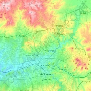
Name: Altındağ topographic map, elevation, terrain.
Location: Altındağ, Ankara, Central Anatolia Region, Turkey (39.92883 32.83074 40.05154 33.11765)
Average elevation: 1,085 m
Minimum elevation: 843 m
Maximum elevation: 1,575 m