
Khandwa Tahsil topographic map
Interactive map
Click on the map to display elevation.
About this map
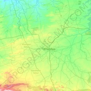
Name: Khandwa Tahsil topographic map, elevation, terrain.
Location: Khandwa Tahsil, Khandwa, Madhya Pradesh, India (21.56109 76.10037 22.12123 76.67190)
Average elevation: 323 m
Minimum elevation: 204 m
Maximum elevation: 710 m
Other topographic maps
Click on a map to view its topography, its elevation and its terrain.
Pipliya
India > Madhya Pradesh > Khandwa Tahsil
Pipliya, Khandwa Tahsil, Khandwa District, Madhya Pradesh, India
Average elevation: 360 m
Siwana
India > Madhya Pradesh > Khandwa Tahsil
Siwana, Khandwa Tahsil, Khandwa District, Madhya Pradesh, India
Average elevation: 292 m
Deshgaon
India > Madhya Pradesh > Khandwa Tahsil
Deshgaon, Khandwa Tahsil, Khandwa, Madhya Pradesh, India
Average elevation: 314 m