
Lakhnadon Tahsil topographic map
Interactive map
Click on the map to display elevation.
About this map
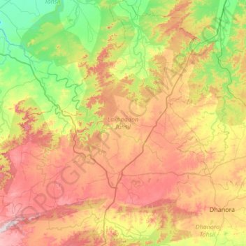
Name: Lakhnadon Tahsil topographic map, elevation, terrain.
Location: Lakhnadon Tahsil, Seoni, Madhya Pradesh, India (22.45594 79.32438 22.95544 79.85302)
Average elevation: 536 m
Minimum elevation: 351 m
Maximum elevation: 785 m
Other topographic maps
Click on a map to view its topography, its elevation and its terrain.