
Anjad topographic map
Interactive map
Click on the map to display elevation.
About this map
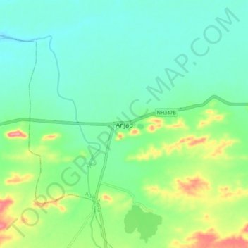
Name: Anjad topographic map, elevation, terrain.
Location: Anjad, Anjad Tahsil, Barwani, Madhya Pradesh, India (22.00163 75.01589 22.08163 75.09589)
Average elevation: 169 m
Minimum elevation: 138 m
Maximum elevation: 249 m