
Kamarhati topographic map
Interactive map
Click on the map to display elevation.
About this map
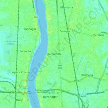
Name: Kamarhati topographic map, elevation, terrain.
Average elevation: 6 m
Minimum elevation: -2 m
Maximum elevation: 15 m
Other topographic maps
Click on a map to view its topography, its elevation and its terrain.
Baranagar
India > West Bengal > Barrackpore
Baranagar, Barrackpore, North 24 Parganas District, West Bengal, 700035, India
Average elevation: 6 m
North Dumdum
India > West Bengal > Barrackpore
North Dumdum, Barrackpore, North 24 Parganas District, West Bengal, 700051, India
Average elevation: 7 m
Dum Dum
India > West Bengal > Barrackpore
Dum Dum, Barrackpore, North 24 Parganas District, West Bengal, 700081, India
Average elevation: 6 m