
Prince Rupert topographic map
Interactive map
Click on the map to display elevation.
About this map
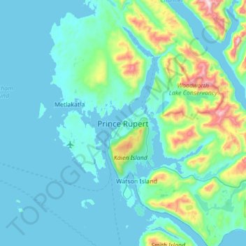
Name: Prince Rupert topographic map, elevation, terrain.
Average elevation: 139 m
Minimum elevation: -1 m
Maximum elevation: 1,164 m
Prince Rupert Airport (YPR/CYPR) is on Digby Island. Its position is 54°17′10″N 130°26′41″W / 54.28611°N 130.44472°W / 54.28611; -130.44472, and its elevation is 35 m (116 ft) above sea level. The airport consists of one runway, one passenger terminal, and two aircraft stands. Access to the airport is typically achieved by a bus connection that departs from downtown Prince Rupert (Highliner Hotel) and travels to Digby Island by ferry. The airport is served by Air Canada from Vancouver International Airport (YVR).