
Stadt Wörgl topographic map
Interactive map
Click on the map to display elevation.
About this map
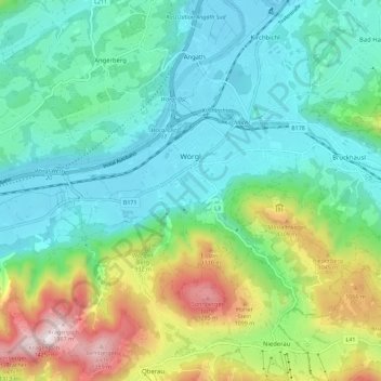
Name: Stadt Wörgl topographic map, elevation, terrain.
Location: Stadt Wörgl, Bezirk Kufstein, Tyrol, 6300, Austria (47.46097 12.02518 47.49971 12.13823)
Average elevation: 740 m
Minimum elevation: 490 m
Maximum elevation: 1,397 m