
Mittur topographic map
Interactive map
Click on the map to display elevation.
About this map
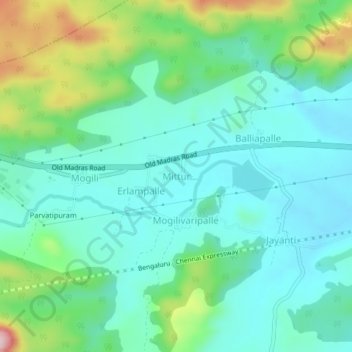
Name: Mittur topographic map, elevation, terrain.
Location: Mittur, Bangarupalem, Chittoor District, Andhra Pradesh, India (13.16530 78.82768 13.20530 78.86768)
Average elevation: 532 m
Minimum elevation: 462 m
Maximum elevation: 742 m
Other topographic maps
Click on a map to view its topography, its elevation and its terrain.
Mitturu
India > Andhra Pradesh > Bangarupalem > Mitturu
Mitturu, Bangarupalem, Chittoor, Andhra Pradesh, 517129, India
Average elevation: 406 m