
Kothapally mandal topographic map
Interactive map
Click on the map to display elevation.
About this map
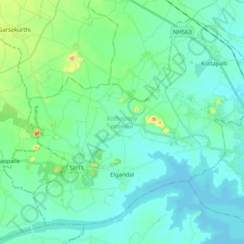
Name: Kothapally mandal topographic map, elevation, terrain.
Location: Kothapally mandal, Karimnagar, Telangana, India (18.39948 78.98597 18.51442 79.12829)
Average elevation: 296 m
Minimum elevation: 271 m
Maximum elevation: 420 m
Other topographic maps
Click on a map to view its topography, its elevation and its terrain.