
Tangapur topographic map
Interactive map
Click on the map to display elevation.
About this map
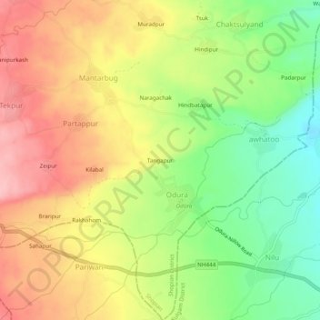
Name: Tangapur topographic map, elevation, terrain.
Location: Tangapur, Odura, Shopian District, Jammu and Kashmir, India (33.65636 74.91475 33.69636 74.95475)
Average elevation: 1,862 m
Minimum elevation: 1,789 m
Maximum elevation: 1,930 m