
Key West topographic map
Interactive map
Click on the map to display elevation.
About this map
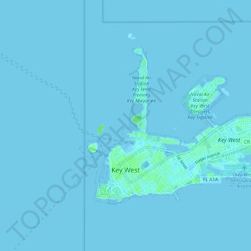
Name: Key West topographic map, elevation, terrain.
Location: Key West, Monroe County, Florida, United States (24.54367 -81.81871 24.59472 -81.72903)
Average elevation: 1 m
Minimum elevation: -2 m
Maximum elevation: 24 m
Key West is an island located at 24°33′55″N 81°46′33″W / 24.565176°N 81.775794°W / 24.565176; -81.775794 in the Straits of Florida. The island is about 4 miles (6 km) long and 1 mile (2 km) wide, with a total land area of 4.2 square miles (10.9 km2; 2,688.0 acres). The average elevation above sea level is about 8 feet (2.4 m) and the maximum elevation is about 18 feet (5.5 m), within a 1-acre (0-hectare) area known as Solares Hill.
Other topographic maps
Click on a map to view its topography, its elevation and its terrain.
Marathon
United States > Florida > Monroe County > Marathon
Marathon, Monroe County, Florida, United States
Average elevation: 0 m