
Thank you for supporting this site ❤️
Make a donation
Make a donation
Mettupalayam topographic map
Click on the map to display elevation.
Thank you for supporting this site ❤️
Make a donation
Make a donation
Mettupalayam
Mettupalayam is located at 11°18′00″N 76°57′00″E / 11.3000°N 76.9500°E / 11.3000; 76.9500. It has an average elevation of 314 metres (1033 feet). Mettupalayam is situated on the bank of Bhavani River at the foot of the Nilgiri mountains.
Thank you for supporting this site ❤️
Make a donation
Make a donation
About this map
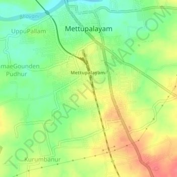
Name: Mettupalayam topographic map, elevation, terrain.
Location: Mettupalayam, Coimbatore, Tamil Nadu, 641301, India (11.27911 76.92622 11.31105 76.95352)
Average elevation: 321 m
Minimum elevation: 291 m
Maximum elevation: 353 m
Thank you for supporting this site ❤️
Make a donation
Make a donation
Other topographic maps
Click on a map to view its topography, its elevation and its terrain.