
Tizit topographic map
Interactive map
Click on the map to display elevation.
About this map
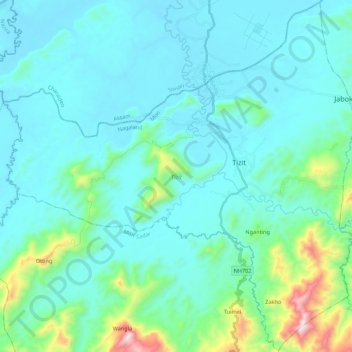
Name: Tizit topographic map, elevation, terrain.
Location: Tizit, Mon District, Nagaland, 798602, India (26.79488 94.93139 26.98748 95.14909)
Average elevation: 236 m
Minimum elevation: 101 m
Maximum elevation: 1,055 m
Other topographic maps
Click on a map to view its topography, its elevation and its terrain.
Naginimora
India > Nagaland > Mon District
Naginimora, Mon District, Nagaland, 798622, India
Average elevation: 260 m