
Erattupetta topographic map
Interactive map
Click on the map to display elevation.
About this map
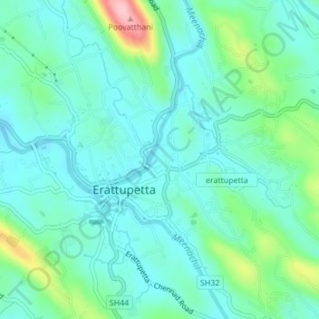
Name: Erattupetta topographic map, elevation, terrain.
Location: Erattupetta, Veyilkanampara, Meenachil, Kottayam, Kerala, India (9.67496 76.76566 9.70731 76.80006)
Average elevation: 52 m
Minimum elevation: 12 m
Maximum elevation: 195 m