
Thanagazi topographic map
Interactive map
Click on the map to display elevation.
About this map
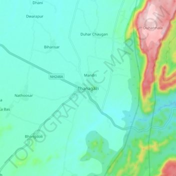
Name: Thanagazi topographic map, elevation, terrain.
Location: Thanagazi, Thanagazi Tehsil, Alwar, Rajasthan, 301022, India (27.35993 76.27649 27.43993 76.35649)
Average elevation: 444 m
Minimum elevation: 376 m
Maximum elevation: 705 m