
Bhaironghati topographic map
Interactive map
Click on the map to display elevation.
About this map
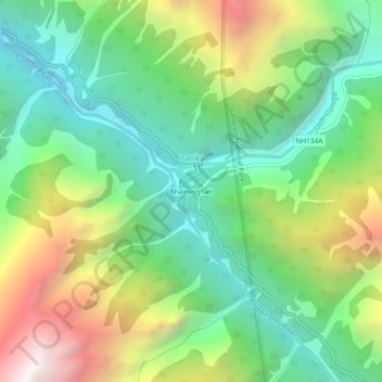
Name: Bhaironghati topographic map, elevation, terrain.
Location: Bhaironghati, Lanka, Bhatwari, Uttarkashi, India (31.00672 78.84788 31.04672 78.88788)
Average elevation: 3,227 m
Minimum elevation: 2,566 m
Maximum elevation: 4,400 m