
Kursk Oblast topographic map
Interactive map
Click on the map to display elevation.
About this map
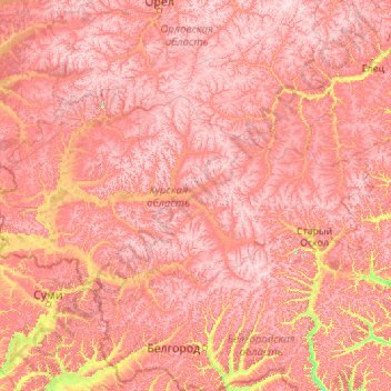
Name: Kursk Oblast topographic map, elevation, terrain.
Location: Kursk Oblast, Central Federal District, Russia (50.90156 34.08022 52.44506 38.51927)
Average elevation: 198 m
Minimum elevation: 88 m
Maximum elevation: 284 m
The oblast, with an average elevation of 177–225 m (581–738 ft), occupies the southern slopes of the middle-Russian plateau. The surface is hilly and intersected by ravines. The central part of Kursk oblast is more elevated than the Seym Valley to the west. The Timsko-Shchigrinsky ridge contains the highest point in the oblast at 288 m (945 ft) above the sea level. The low relief, gentle slopes, and mild winters make the area suitable for farming, and much of the forest has been cleared.
Other topographic maps
Click on a map to view its topography, its elevation and its terrain.
Kursk
Russia > Kursk Oblast > Kursk
Kursk, Kursk Oblast, Central Federal District, Russia
Average elevation: 192 m