
Andújar topographic map
Interactive map
Click on the map to display elevation.
About this map
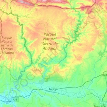
Name: Andújar topographic map, elevation, terrain.
Location: Andújar, Jaén, Andalusia, Spain (37.96536 -4.27866 38.40182 -3.85988)
Average elevation: 483 m
Minimum elevation: 153 m
Maximum elevation: 1,281 m