
Drenthe topographic map
Interactive map
Click on the map to display elevation.
About this map
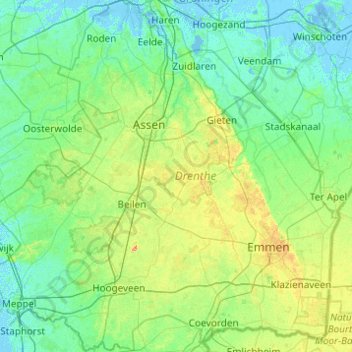
Name: Drenthe topographic map, elevation, terrain.
Location: Drenthe, Netherlands (52.61220 6.11982 53.20383 7.09274)
Average elevation: 9 m
Minimum elevation: -6 m
Maximum elevation: 49 m