
Kralendijk topographic map
Interactive map
Click on the map to display elevation.
About this map
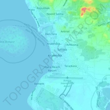
Name: Kralendijk topographic map, elevation, terrain.
Location: Kralendijk, Bonaire, Netherlands, 1234AB, Netherlands (12.10729 -68.31402 12.18729 -68.23402)
Average elevation: 9 m
Minimum elevation: -2 m
Maximum elevation: 114 m