
Frisia topographic map
Interactive map
Click on the map to display elevation.
About this map
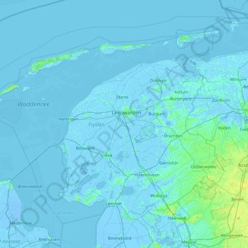
Name: Frisia topographic map, elevation, terrain.
Location: Frisia, Netherlands (52.76481 4.81838 53.53971 6.42761)
Average elevation: 1 m
Minimum elevation: -7 m
Maximum elevation: 47 m
Other topographic maps
Click on a map to view its topography, its elevation and its terrain.