
Murud topographic map
Interactive map
Click on the map to display elevation.
Murud
Murud is located at 18°20′N 72°58′E / 18.33°N 72.96°E / 18.33; 72.96. It has an average elevation of 7 metres (26 feet).
About this map
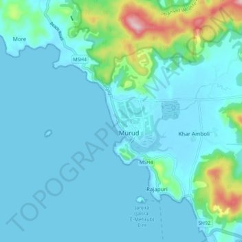
Name: Murud topographic map, elevation, terrain.
Location: Murud, Raigad, Maharashtra, 402400, India (18.28577 72.91772 18.36577 72.99772)
Average elevation: 39 m
Minimum elevation: -5 m
Maximum elevation: 293 m