
Tapis topographic map
Interactive map
Click on the map to display elevation.
About this map
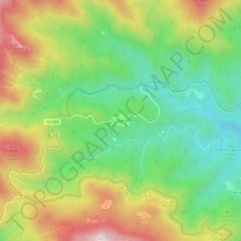
Name: Tapis topographic map, elevation, terrain.
Average elevation: 647 m
Minimum elevation: 379 m
Maximum elevation: 1,025 m
Other topographic maps
Click on a map to view its topography, its elevation and its terrain.
Turó del Bac
Espagne > Catalogne > Haut-Ampurdan > Maçanet de Cabrenys
Turó del Bac, el Bac, Maçanet de Cabrenys, Haut-Ampurdan, Gérone, Catalogne, Espagne
Average elevation: 689 m