
Katugasthota topographic map
Interactive map
Click on the map to display elevation.
About this map
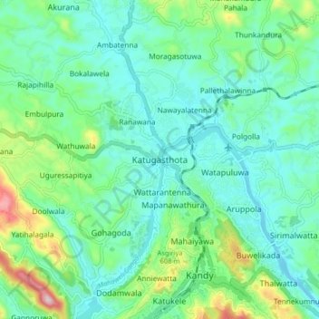
Name: Katugasthota topographic map, elevation, terrain.
Location: Katugasthota, Kandy District, Central Province, 20032, Sri Lanka (7.28208 80.58496 7.36208 80.66496)
Average elevation: 503 m
Minimum elevation: 430 m
Maximum elevation: 748 m