
Hullahalli topographic map
Interactive map
Click on the map to display elevation.
About this map
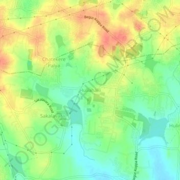
Name: Hullahalli topographic map, elevation, terrain.
Location: Hullahalli, Anekal, Bangalore Urban, Karnataka, 560105, India (12.80673 77.59705 12.84673 77.63705)
Average elevation: 922 m
Minimum elevation: 898 m
Maximum elevation: 947 m