
Bowatta topographic map
Interactive map
Click on the map to display elevation.
About this map
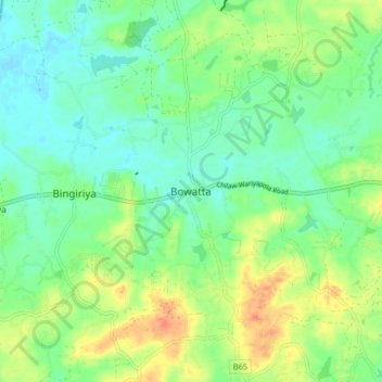
Name: Bowatta topographic map, elevation, terrain.
Location: Bowatta, Kurunegala District, North Western Province, Sri Lanka (7.55869 79.92196 7.63869 80.00196)
Average elevation: 29 m
Minimum elevation: 12 m
Maximum elevation: 58 m