
Kabanigiri topographic map
Interactive map
Click on the map to display elevation.
About this map
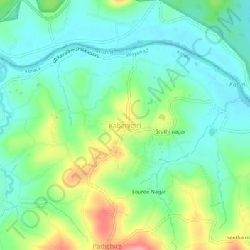
Name: Kabanigiri topographic map, elevation, terrain.
Location: Kabanigiri, Sulthanbathery, Wayanad, Kerala, 673549, India (11.83895 76.16180 11.87895 76.20180)
Average elevation: 725 m
Minimum elevation: 692 m
Maximum elevation: 797 m