
Bhatpara topographic map
Interactive map
Click on the map to display elevation.
About this map
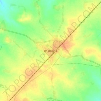
Name: Bhatpara topographic map, elevation, terrain.
Location: Bhatpara, Bhatapara Tahsil, Baloda Bazar, Chhattisgarh, India (21.69535 81.90446 21.77535 81.98446)
Average elevation: 264 m
Minimum elevation: 245 m
Maximum elevation: 278 m
Bhatpara is located at 22°52′N 88°25′E / 22.87°N 88.41°E / 22.87; 88.41. It has an average elevation of 12 metres (39 feet). The main town is sandwiched between the Hoogly river in the west and railway track linking Sealdah and Krishnanagar in the east.