
Lonand topographic map
Interactive map
Click on the map to display elevation.
About this map
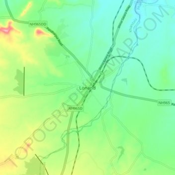
Name: Lonand topographic map, elevation, terrain.
Location: Lonand, Khandala, Satara, Maharashtra, 415521, India (17.99880 74.14693 18.07880 74.22693)
Average elevation: 599 m
Minimum elevation: 553 m
Maximum elevation: 703 m