
Portage Glacier topographic map
Interactive map
Click on the map to display elevation.
About this map
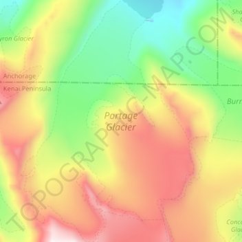
Name: Portage Glacier topographic map, elevation, terrain.
Location: Portage Glacier, Anchorage, Alaska, Anchorage (60.69206 -148.85086 60.75521 -148.75840)
Average elevation: 836 m
Minimum elevation: 204 m
Maximum elevation: 1,657 m
Other topographic maps
Click on a map to view its topography, its elevation and its terrain.