
Katra topographic map
Interactive map
Click on the map to display elevation.
About this map
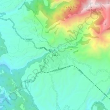
Name: Katra topographic map, elevation, terrain.
Location: Katra, Reasi, Reasi District, Jammu and Kashmir, 182301, India (32.95249 74.89181 33.03249 74.97181)
Average elevation: 993 m
Minimum elevation: 465 m
Maximum elevation: 2,651 m
Other topographic maps
Click on a map to view its topography, its elevation and its terrain.
Salal
India > Jammu and Kashmir > Reasi
Salal, Reasi, Reasi District, Jammu and Kashmir, India
Average elevation: 664 m
Bakkal
India > Jammu and Kashmir > Reasi
Bakkal, Reasi, Reasi district, Jammu and Kashmir, India
Average elevation: 922 m