
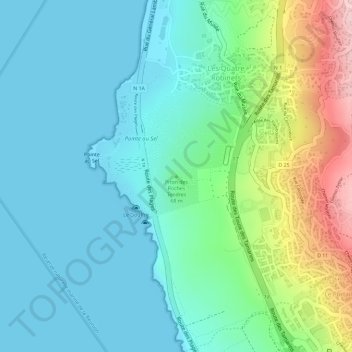
Piton des Roches Tendres topographic map
Interactive map
Click on the map to display elevation.
About this map
Name: Piton des Roches Tendres topographic map, elevation, terrain.
Average elevation: 64 m
Minimum elevation: 0 m
Maximum elevation: 251 m
Other topographic maps
Click on a map to view its topography, its elevation and its terrain.
Saint-Leu
France > La Réunion > Saint-Leu > Saint-Leu
Saint-Leu, Saint-Paul, La Réunion, 97436, France
Average elevation: 272 m
Ravine de la Fontaine
France > La Réunion > Saint-Leu > Le Cap-Camélias
Ravine de la Fontaine, Le Cap-Camélias, Saint-Leu, Saint-Paul, La Réunion, 97416, France
Average elevation: 392 m