
Enniskillen Castle topographic map
Interactive map
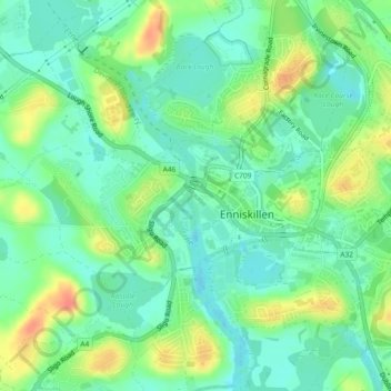
Click on the map to display elevation.
About this map
Name: Enniskillen Castle topographic map, elevation, terrain.
Average elevation: 54 m
Minimum elevation: 36 m
Maximum elevation: 85 m
Other topographic maps
Click on a map to view its topography, its elevation and its terrain.
Lower Lough Erne
United Kingdom > Northern Ireland > Enniskillen > Lisnarrick
Lower Lough Erne, Enniskillen, County Fermanagh, Northern Ireland, BT93 2BX, United Kingdom
Average elevation: 96 m
Enniskillen
United Kingdom > Northern Ireland > Enniskillen
Enniskillen, County Fermanagh, Northern Ireland, United Kingdom
Average elevation: 54 m