
Chas topographic map
Interactive map
Click on the map to display elevation.
About this map
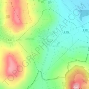
Name: Chas topographic map, elevation, terrain.
Average elevation: 399 m
Minimum elevation: 323 m
Maximum elevation: 551 m
Chas is located at 23°38′N 86°10′E / 23.63°N 86.17°E / 23.63; 86.17. It has an average elevation of 210 metres (688 feet). It is situated on the junction of National Highway 23 and National Highway 32. Chas is situated on the banks of Garga river and Dhanbad-Bokaro-Ranchi Expressway passes through it.