
Homer topographic map
Interactive map
Click on the map to display elevation.
About this map
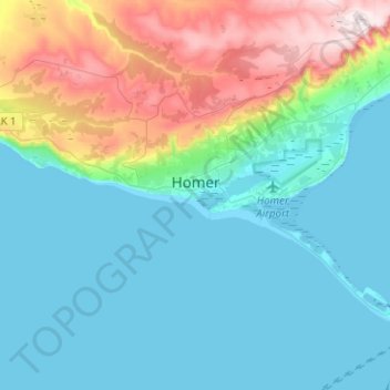
Name: Homer topographic map, elevation, terrain.
Location: Homer, Kenai Peninsula, Alaska, United States (59.59827 -151.65504 59.68130 -151.40400)
Average elevation: 103 m
Minimum elevation: 0 m
Maximum elevation: 449 m
Many of the birds seen during the festival can be identified with the help of published guides that categorize distinguishable features such as, topography, silhouette, size, and color.