
Kaunas District Municipality topographic map
Interactive map
Click on the map to display elevation.
About this map
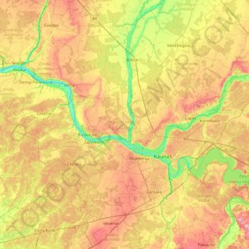
Name: Kaunas District Municipality topographic map, elevation, terrain.
Location: Kaunas District Municipality, Kaunas County, Lithuania (54.71925 23.41236 55.20203 24.24717)
Average elevation: 66 m
Minimum elevation: 8 m
Maximum elevation: 133 m
Other topographic maps
Click on a map to view its topography, its elevation and its terrain.
Garliava
Lithuania > Kaunas County > Garliava
Garliava, Garliavos seniūnija, Kaunas District Municipality, Kaunas County, Lithuania
Average elevation: 74 m