
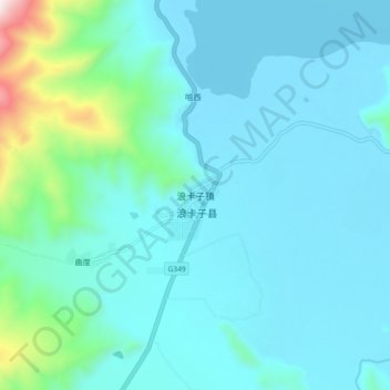
Nagarzê topographic map
Interactive map
Click on the map to display elevation.
About this map
Name: Nagarzê topographic map, elevation, terrain.
Location: Nagarzê, Nagarzê County, Shannan, Tibet, PRC (28.93020 90.35603 29.01020 90.43603)
Average elevation: 4,571 m
Minimum elevation: 4,444 m
Maximum elevation: 5,423 m