
Dhamrai topographic map
Interactive map
Click on the map to display elevation.
About this map
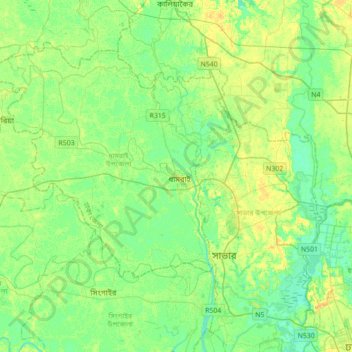
Name: Dhamrai topographic map, elevation, terrain.
Average elevation: 9 m
Minimum elevation: 0 m
Maximum elevation: 21 m
Other topographic maps
Click on a map to view its topography, its elevation and its terrain.
Dhaleshwari River
Bangladesh > Dhaka Division > Dhamrai
Dhaleshwari River, Dhamrai, Dhamrai Subdistrict, Dhaka District, Dhaka Division, 1334, Bangladesh
Average elevation: 8 m