
Manhattan Valley topographic map
Interactive map
Click on the map to display elevation.
About this map
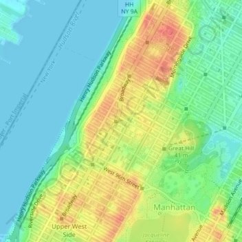
Name: Manhattan Valley topographic map, elevation, terrain.
Average elevation: 23 m
Minimum elevation: 0 m
Maximum elevation: 61 m
Other topographic maps
Click on a map to view its topography, its elevation and its terrain.
Roosevelt Island
USA > New York > New York City
Roosevelt Island, Manhattan Community Board 8, New York County, New York City, New York, 10044, USA
Average elevation: 13 m
Barren Island
USA > New York > New York City
Barren Island, Kings County, New York City, New York, 11697, USA
Average elevation: 16 m