
Redeyef topographic map
Interactive map
Click on the map to display elevation.
About this map
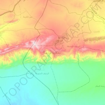
Name: Redeyef topographic map, elevation, terrain.
Location: Redeyef, Gafsa, Tunisie (34.22010 8.04168 34.48593 8.34801)
Average elevation: 323 m
Minimum elevation: -4 m
Maximum elevation: 902 m
Other topographic maps
Click on a map to view its topography, its elevation and its terrain.