
Sanibel Island topographic map
Interactive map
Click on the map to display elevation.
About this map
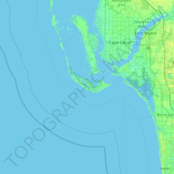
Name: Sanibel Island topographic map, elevation, terrain.
Average elevation: 1 m
Minimum elevation: -1 m
Maximum elevation: 21 m
Other topographic maps
Click on a map to view its topography, its elevation and its terrain.
Wulfert
United States > Florida > Lee County > Sanibel
Wulfert, Sanibel, Lee County, Florida, 33926, United States
Average elevation: 1 m
Ybel
United States > Florida > Lee County > Sanibel
Ybel, Sanibel, Lee County, Florida, 33957, United States
Average elevation: 2 m