
Pagladia topographic map
Interactive map
Click on the map to display elevation.
About this map
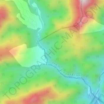
Name: Pagladia topographic map, elevation, terrain.
Average elevation: 453 m
Minimum elevation: 210 m
Maximum elevation: 842 m
Other topographic maps
Click on a map to view its topography, its elevation and its terrain.
Deothang
Bhutan > Samdrup Jongkhar District > Dewathang Gewog > Chhenangri_Rishor > Deothang
Deothang, Chhenangri_Rishor, Dewathang Gewog, Samdrup Jongkhar District, Bhutan
Average elevation: 660 m