
Ukerewe topographic map
Interactive map
Click on the map to display elevation.
About this map
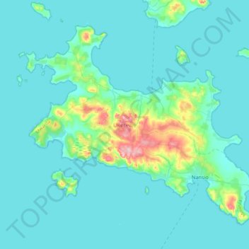
Name: Ukerewe topographic map, elevation, terrain.
Location: Ukerewe, Mwanza, Lake Zone, Tanzania (-2.17764 32.82023 -1.88532 33.18587)
Average elevation: 1,151 m
Minimum elevation: 1,131 m
Maximum elevation: 1,321 m