
Thenmala topographic map
Interactive map
Click on the map to display elevation.
About this map
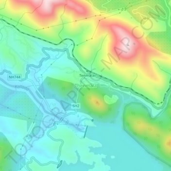
Name: Thenmala topographic map, elevation, terrain.
Location: Thenmala, Punalur, Kollam District, Kerala, 691308, India (8.94527 77.04996 8.98527 77.08996)
Average elevation: 212 m
Minimum elevation: 66 m
Maximum elevation: 560 m
Other topographic maps
Click on a map to view its topography, its elevation and its terrain.