
Saltash topographic map
Interactive map
Click on the map to display elevation.
About this map
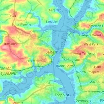
Name: Saltash topographic map, elevation, terrain.
Average elevation: 32 m
Minimum elevation: -4 m
Maximum elevation: 110 m
Other topographic maps
Click on a map to view its topography, its elevation and its terrain.
Wearde Quay
United Kingdom > England > Saltash > Wearde Quay
Wearde Quay, Saltash, Cornwall, South West England, England, PL12 4AT, United Kingdom
Average elevation: 24 m