
Gajwel topographic map
Interactive map
Click on the map to display elevation.
About this map
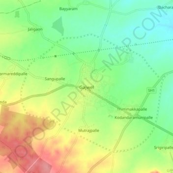
Name: Gajwel topographic map, elevation, terrain.
Average elevation: 568 m
Minimum elevation: 532 m
Maximum elevation: 620 m
The town is located on the Deccan Plateau and is surrounded by agricultural lands. It lies at an average elevation of around 540 meters (1,770 feet) above sea level. The area is characterized by undulating terrain with scattered hills and valleys.
Other topographic maps
Click on a map to view its topography, its elevation and its terrain.
Pragnapur
India > Telangana > Gajwel mandal
Pragnapur, Gajwel mandal, Siddipet District, Telangana, 502281, India
Average elevation: 565 m