
Kushtagi topographic map
Interactive map
Click on the map to display elevation.
Kushtagi
Kushtagi is located at 15°46′N 76°12′E / 15.77°N 76.2°E / 15.77; 76.2. It has an average elevation of 639 metres (2096 feet). The area is dry and prone to drought.
About this map
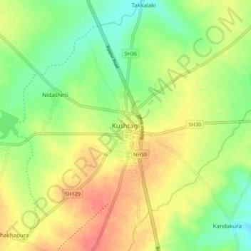
Name: Kushtagi topographic map, elevation, terrain.
Average elevation: 637 m
Minimum elevation: 609 m
Maximum elevation: 668 m