
Collingwood topographic map
Interactive map
Click on the map to display elevation.
About this map
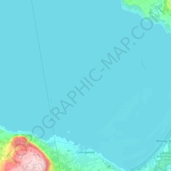
Name: Collingwood topographic map, elevation, terrain.
Location: Collingwood, Simcoe County, Central Ontario, Ontario, Canada (44.46998 -80.34862 44.76514 -80.14039)
Average elevation: 190 m
Minimum elevation: 172 m
Maximum elevation: 520 m
Other topographic maps
Click on a map to view its topography, its elevation and its terrain.