
Phase II topographic map
Interactive map
Click on the map to display elevation.
About this map
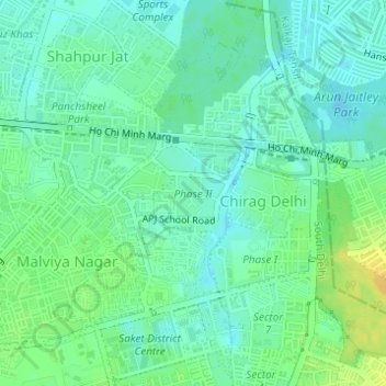
Name: Phase II topographic map, elevation, terrain.
Location: Phase II, Sheikh Sarai, Tigri, South Delhi, Delhi, India (28.53533 77.21698 28.54199 77.22669)
Average elevation: 227 m
Minimum elevation: 218 m
Maximum elevation: 242 m
Other topographic maps
Click on a map to view its topography, its elevation and its terrain.