
Lake Manasarovar topographic map
Interactive map
Click on the map to display elevation.
About this map
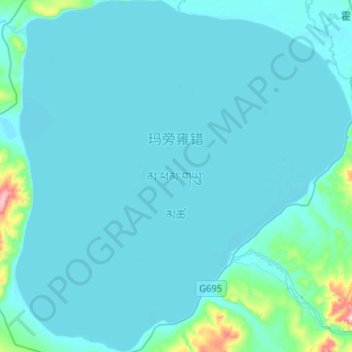
Name: Lake Manasarovar topographic map, elevation, terrain.
Average elevation: 4,604 m
Minimum elevation: 4,582 m
Maximum elevation: 4,936 m
Lake Manasarovar lies at 4,590 m (15,060 ft) above mean sea level, a relatively high elevation for a large fresh water lake on the mostly saline lake-studded Tibetan Plateau.